


Topographical Maps
(Excursions)
Workout
A. Draw the contour diagrams of :
1. Conical hill.
=

2. Plateau.
=

3. Ridge.
=

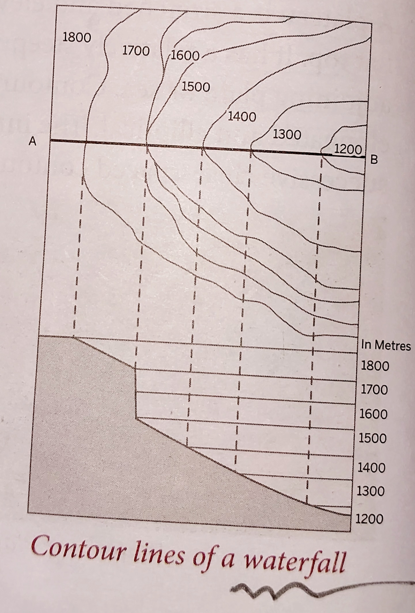
4. Waterfall.
=
5. Cliff.
=

B. Explain these terms:
1. Contour.
= Contours are imaginary lines that join the places of the same height or elevation above the mean sea level.
2. Triangulated height.
= Triangulated height is the height is the height of a place calculated using triangle properties and trigonometry. It is represented by a small triangle, for example Δ540.
3. Bench mark.
= Bench mark is the height of a place marked on a stone pillar or rock or shown on a building as a permanent reference.
4. Spot height.
= Spot height is the height of random places between contours. It is represented with a dot, for example, .425. Spot heights are used to provide information about the land surface between contours and are written next to contour lines.
C. Answer these questions in detail.
1. What are settlement patterns?
= A settlement is a group of human dwellings in urban and rural areas. Settlements and buildings are important cultural features shown on topographical sheets using conventional signs, symbols and colours. Settlements have several purposes - they may be residential, commercial or centres of trade and commerce.
Settlements patterns are important because they reflect a great deal on the land use and economic activities of people. Settlements may be temporary or permanent.
2. Explain the significance of topographical maps.
= Topographical maps are maps of a small area that show minute details. These maps are drawn on large scales with distinct features such as relief, vegetation, water bodies, cultivated land, settlements and transportation networks.
❐ Relief Representation : The Earth is spherical and its crust is uneven because of high mountains, deep valleys and vast plains. The elevations and depressions of the Earth's surface are known as physical or relief features. A map that shows these features is called a relief map. Representation three-dimensional structures on a two-dimensional map is challenge for cartographers. Methods such as hachures, hill-shading, layer tinting, benchmarking, spot heights and contours help us understand the relief of a place. Making contours is the most accurate and perhaps the most interesting way to understand reliefs.
❐ Contours : In topographical map, brown lines indicate contour lines. If you observe carefully, you will notice that some numbers are written closely along the contour lines. These number show the height of the particular contour. Surveys and levelling are some of the conventional methods used for drawing contours on topographical maps. However, this method has now been replaced by more advanced methods such as land and aerial photography.
3. Explain the difference between permanent and temporary settlements.
=
|
Permanent Settlement |
Temporary Settlement |
|---|---|
|
1. Places where people build permanent houses are called permanent
settlements. |
1. Settlements that are occupied for a short period of time are
called temporary settlements. |
|
2. Cities like Kolkata, Bengaluru, Mumbai, Delhi and Chennai have a
large number of permanent settlements. |
2. These settlements mostly include kuchcha houses that are made of
mud, straw and tarpaulin. |
|
3. These settlements are represented with red squares(🟥) on
topographical maps. |
3. Such settlements are usually indicated with a square(⬜) on
topographical maps. |
4. What is the difference between a col and a saddle?
= The gap between two summits of a ridge are at an altitude, it is said to be a col or a pass. It is a part of the ridge where the contours drop then rise gradually.
On the other hand, a saddle is a shallow depression between two summits with gentle slopes. It is similar to a col but contours are widely-spaced.
5. What do the contour lines of a plateau look like?
= Contour lines representing a plateau are elongated and elliptical. The innermost contour is broad with successive close-spaced contours. A plateau is a stretched and elevated part of land with a flat top. It has a relatively steeper slope and rises above the adjoining plain or sea.